
Manuel Marulanda. Leader of the FARC, also known as "tiro Fijo" (sure shot)
Work by Colombian artist Fernando Botero and in displayed at Colecion Botero museum in Bogota.
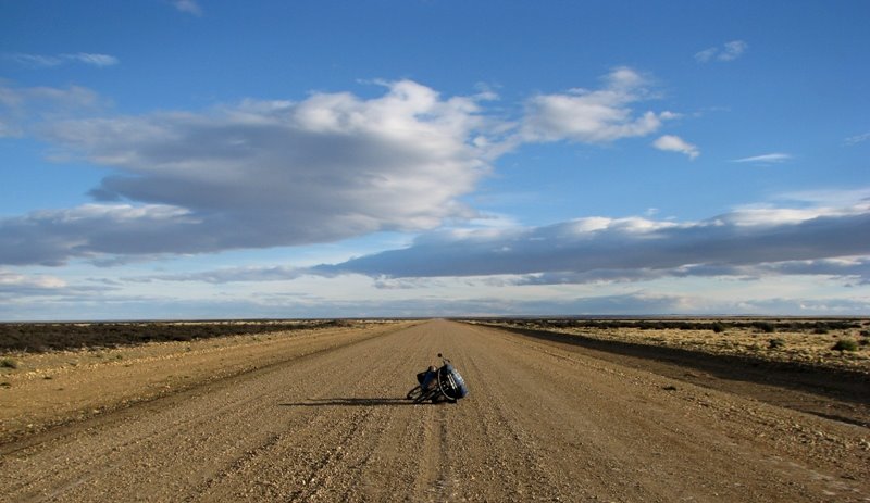
Villa de Leyva
After the daily ritual of packing everything up and load the "Burra", I leave the city of Barbosa covered in the morning fog, and cycle through the road that will take me to the Colombia capital. I leave the "Lusitania" hotel, where in the previous night I tried in vain to explain to the owner that I also came from a country called "lusitania". "its 5000 pesos", she replied showing no interest in my enthusiasm.
I start the day with a accentuated climb, as to digest breakfast of "caldo de pollo" and "bandeja de carne sudada" (chicken broth and meat dish) that I had in a small "comedor", on the way out of town. The clouds deprived the earth from the morning heat and insisted in hiding the sun. The cool air and the dark green of the fields created by the grey sky, remembered me of certain European landscapes. It has been over a week that I cycle in the highlands, and despite the altitudes not exceeding the 3000 meters, it makes me reach for the deeps of my panniers in search of warmer cloths.
I travel now in a very different Colombia. Villages and towns with a lot of colonial heritage and populated mainly by European descendants, and with a higher standard of living then in the Caribbean coast. The traffic was heavy and the shoulders non-existent, what kept me in a state of constant alert. A price to pay for following the rule of traveling safely in Colombia: Cycle in the main highways.


Everyone seems to agree that its safer to cycle in heavy traffic roads subject to be run over by a truck, then in back roads with no traffic deep in the country side, where encounters with followers of "Tiro Fijo" are more likely. But I travel now in the province of Santander, the Colombian heart, and the place where Simon Bolivar defied the Spanish crown for the independence of an united America, and considered a "safe zone" to travel, where such encounters are not a concern.
Near Arcabuco I leave the heavy traffic road and follow a partially paved road heading to the colonial town of Villa de Leyva. In mid afternoon the sun wins the fight against the clouds and illuminates the "valle de los dinosauros", in whose northern hillside sits the beautiful villa de leyva.
In villa de leyva time stands still. Declared a national monument in the same year Fidel invaded Cuba, the town is completely deprived of modern architecture, and the result is a colonial village par excellence of cobbled streets white washed houses and Iberian red roofing tiles. Its proximity to Bogota also means that it is a place of leisure for rich city dwellers, and the atmosphere, although pretty, has a certain artificial air.


I lodge myself in a guesthouse whose owner tells me that there are other cyclists in the house. They are Colombians who had come to town to participate in 4ª international cycling race of the Valle de los Dinossauros. One of their colleagues couldn't participate and they invited me to take his place.
In Colombia, cycling is king. Is the second sport modality with more fans, surpassed only by (of course) soccer. Since I left the flat lands and climbed the mountains, almost everyday I see lycra-cyclists on their well equipped bicycles. Many of them of Superior quality them my "burra".
The following morning the sky was dark and grey so I decide not to participate in the race and give myself a day rest. The last few days have been very hard on my legs and besides, I didn't feel like making myself look silly in the middle of so much Lycra guys. In mid morning the sun opened up the sky and I go for a small 40 k ride in the valley visiting the astronomical Muisca station, some sort of Stonehenge of the Muisca Indians with its monolithic rocks. A place where they predicted the harvests and one of the few places of their culture the Spaniards hadn't grounded on their destructive conquering.
2 days latter I continue my journey to Tunja, the highest department capital of Colombia at 2800 metres of altitude. In the ascent I make my first pass above 3000 meters in south American soil through a pretty barren landscape. I spend a cold night in Tunja and take the next day off to buy warmer cloths, preparing for the colder climate of the Andes.


Before reaching Bogota I stop for a couple of days in Zipaquira known in all Colombia for its salt mines. I visited one of them, in whose corridors, deep in the heart of the mountain, a cathedral entirely made of salt was built. Capable of accommodate 4500 people, it is considered by the department of Colombian tourism as one of the 7 wonders of the country. It was an interesting visit that was marked by a fall in the darkness, over a rock of salt, when trying to photograph an angel in certain angle and that resulted in my camera been broken. (I travel now with a simple digital camera, hence the photos of inferior quality)


Bogota

Seen from far, the disordered constructions, sprout of the land like a gigantic eruption of red bricks. They are hundreds, thousands. Houses constructed in free time with the aid of neighbors and family. Doors and windows out of symmetry are covered with iron bars, and the chaises of the foundations pop above concrete celling like television antennas. Many hold hanging cloths that dry in the polluted air of the great metropolis.
The jeep Willys of 1954 from Herman, a biologist of the national university of Bogota, climbs with difficulty one of innumerable mounts where Ciudad Bolivar is constructed, the poorest neighborhood of the Colombian capital. Dayra Galvis, an old friend, and my host in Bogota, had asked her uncle to take us there. She didn't dare to come alone. Its dangerous, she said. I have asked her to show me around. I wanted to see where nearly 2 million of 7 millions of inhabitants of the Colombian capital lived.
But the slums of Ciudad Bolivar are not the ghettos of Cape town or the favelas of Rio de Janeiro. Despite the violence and delinquents, one feels some dignity on those slums, with commerce, restaurants and even Internet cafes.
On top of the hill we got to see central Bogota, just a few kilometers north, with La Cadelaria as historical heart of the city, a zone with innumerable cafes, churches, museums and colonial buildings.


The contrasts with the slums around me where abysmal and become even more dramatic as one travels further to the north of the city. Here, north of carrera 93the "rolos", residents of Bogota, have turned their back to history and embraced capitalism and modern values. Shopping centers Uncle Sam style, international gastronomy and neighborhoods with sophisticated atmospheres, that seem to differ little from many European cities (including in the prices) contrast violently with ciudad bolivar just a few kilometers south.
During the 4 days I spent in Bogota, the Galvis family treated my with a great hospitality. visits to nice restaurants ( Mini-Mal, recommended), familiar suppers and guided tours, with Luis, the family taxi driver, at my disposal in the days when the "peak and plate" system did not allow the use of the family`s car. A warm hospitality, characteristic of this fantastic people and very appreciated, by someone that is accustomed to the saddle (already ragged) of the bike, to the (dis)comfort of the tent, and the dust of the roads.
I wish I could known better the capital with its vibrant atmosphere, and to spend more time with my friends, but I have to continue my trip.


Changing cordilleras
Before I leave, Herman offers me an excellent Colombian road map together with detailed information of my next stage on this journey: the change of cordilleras. Bogota, 2600 meters closer to the stars (a Colombian saying) sit on the eastern mountain range. My foreseen route to Ecuador follows the Cauca valley between the central mountain range and the western mountain range.swapping mountain range means that I have to go down to the bottom of Magdalena river valley (350 meters of altitude) climb up the central mountain range up to almost 4000 meters, and then go down to Manizales (at 2100m), one of the so called "coffee axle" towns, and my next destination.

Herman tells me of a alternative route that is (supposedly) downhill all the way to Cambao, on the banks of Magdalena river. From there I could follow a asphalt road along the river to Honda, where I would begin the climb to Las Letras pass.
I say farewell to the Galvis family (and Nancy Sanchez) and leave the capital with the same easiness that I had entered. For a metropolis of more than 7 million inhabitants, one could think that it would be difficult and even dangerous to cycle through it. But in fact it was very easy. Bogota is one of the most cyclist-friendly capitals in the world. There is about 300 km (yes, 300) of bike route spread all over the city, including many main highways that on Sundays are closed to the motorized traffic. The city council offers concessions the small "tiendas" that sell food and drinks in the ciclovias and even bike repairing shops. It is a pleasure to see the congested traffic, while hundreds of "rolos" and their families enjoy the tranquility of the streets on their "ciclas".
I cross the Savannah of Bogota and cycle west on the main highway until Alban, then leave the heavy traffic road and start a nice and accentuated downhill. Just before Viani (1200 meters) the road refuses to go down any further and inverts the inclination, starting to climb up to 1800 meters. A recent landslide obstructed the road and cuts off the traffic completely between Alban and Cambao, and I have the road to myself for about 50 km.
Vivan los derubes!


I spent a night in San Juan de Rioseco and in the following morning make the final downhill (also without traffic) until Cambao. I had returned to "tierras calientes", the lowlands, with temperatures reaching the 35 degrees and high levels of humidity. I follow a supposedly asphalted road parallel to the enigmatic Magdalena river. Stage of the final trip of Simon bolivar, described in Gabriel Garcia Marques book "the general and his labyrinth".
After a few km the road deteriorates fast and became, at times, no more then a mud track. I have to push the bike and stop several times to remove the mud accumulated in the mudguards and breaks.


I arrive in Honda in mid afternoon and with 87 km made, I call it a day and look for a hotel. I have a 3400 meters climb ahead of me and decided to spilt it in 2 days. Honda is a pleasant town. The old fluvial port of Bogota in the times that the river Magdalena (navigable for 990 km from Honda to Barranquilla in the Caribbean sea) served as the main transport artery of the country.
The following morning I start what was the biggest ascend of the trip so far. The road only starts to climb in Mariquita, about 35 km west of Honda. I spent all day climbing accumulating 2116 meters in only 66 km. Spent in the night in Padua and the following morning make the remaining climb to the pass of Las Letras at 3750 meters of altitude. Close to the pass the temperatures drop drastically, making me dig deep in the panniers in search of warmer cloths. I didn't have such cold cycling, since the rocky mountains in the US. Unfortunately the constant fog hide the landscape, allowing me only brief moments of splendid views of the valleys of central cordillera.


I cycle trough Manizales already after dark. Waiting for me was Andrea Molina, an old friend and fellow traveller in northern Argentina and Uruguay in 2005.
Manizales has little to offer to the visitor, but I will stop here for a while. Perhaps one week or two. I intend to visit the dentist an do a mouth reconstruction (for a fraction of the European prices)
After that I will be cycling rushing trough the Cauca valley. I hope to arrive in Quito at the beginning of December. Just on time for the Thames mermaid return to the pan-American.
Nuno Brilhante Pedrosa
In Manizales, Colombia
