Rest days in Quetena Chico

“Family" picture with Mrs. Modesta, Mr. Marcelino, their sons, and Didiana and Jeronimo, a couple from São Paulo (traveling with a tour), in front of hostel Condor in Quetena Chico, where we all spent some good times during the 2 days before initiating our climb to the top of Uturunco.
Day 39
From Quetena Chico to the base of volcano Uturunco.
15.3km
Maximum Altitude 4477m
Camp Altitude 4477m
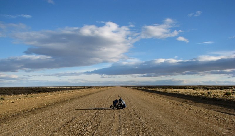
Today was a very hard day. The problems began early in the morning when we visit the “flota” (a bus turned into a mini-market), parked in the dusty main plaza, it had nothing for sale. We were told that it would have vegetables and fruit brought in from Uyuni, but this time the “flota” was empty, the lady in charge didn’t travel to Uyuni on that week. In an action of despair we begin to knock on peoples doors and ask to buy some food from them. We managed to find some vegetables with some canned food that we had bought the previous day. We fill-up the bottles, 11 liters total, from Mrs. Modest well and at 11:45 hours we were set to leave.

Quetena Chico main square
Despite Mr. Marcelino having told us that there was no water beyond an abandoned camp at the base of the volcano we were hopping to find some snow or ice at the top, which we could use for drinking and cooking, but what we didn’t expect was to find all the ice contaminated by sulfur. The directions of Mr. Marcelino that the previous day had hiked with me to the top of a small peak behind the village to explain the best road to take were good enough. Without those indications we would not be able to decipher the myriad of roads that there are at the exit of the village.

The progress was very slow, the road was in some terrible conditions, but we could pedal on some times. In the two days we spent in Quetena Chico we had not eaten well and I felt weak. Despite leaving some of the gear in the village, the water and food added enough weight to my load, probably more than 40 kg. I was constantly following behind; Joana was going at a good rhythm, since her load was considerably lighter.


At one time we stopped to discuss about the weight of the bicycles and my weak performance. We were having a bad start and moral was degrading. At the end of the day we had traveled just 15 km with barely 400m of ascent accumulated. We stopped frequently to recuperate strengths. We had just started the climb and I already begin to question if we could make it all the way to the top, and most importantly, would it be worth the hard effort? The road was simply disastrous with loss rocks and sandy patches where we had to drag our bikes, pushing was not enough.
At 10 km from Quetena Chico we pass the abandoned camp with a small stream nearby. Despite the water tasting like dirt, we filled up all our bottles. The road in disuse begins to move slowly away from the pampa (prairie) and approaches the base of the volcano. We setup camp at 4477 meters. Tomorrow we will try to climb 650m up to 5150m. It may seem an un-ambitious number, but given the conditions of the road, the heavy load we’re caring and the high altitude, it will be a true challenge.
Day 40
From the base of Uturunco to somewhere mid way up.
8.9km
Maximum Altitude 5138m
Camp Altitude 5138m
It was 10:30 in the morning when we left the campsite and we continue on pushing the bicycles up the mountain. We were determined to continue. At km 18.9 from Quetena Chico we reached 4700m altitude. From here on, we initiated a series of switchbacks, with inclinations over 10%. At that altitude our “Burras”(donkeys, name of our bikes) refused to be mounted and the progress was very slow. We slogged along at 2/3 km per hour, stopping every 30 to 40 meters to catch our breath.
For almost a year we’ve been pedaling through the spine of the Andean mountain range, the thousands of kilometers traveled in these mountain roads have convinced me that the higher the road goes the less aggressive the inclination gets, something that had proved to be true when we passed above the 4000 meters in Ecuador and Peru, but here, in the Southwest of the Bolivian plateau, the roads seem to break all rules and at 4500 meters inclinations still go over and above 15%. The road seems to climb slopes thru the same path lines that the rain water opened as if nobody is going to use them.
This torturous road was built about 20 years ago to give access to a sulfur mine at the top of the volcano, with the fall of prices for this mineral the mine closed and the road fell in disuse. Nowadays it’s only used by the few adventurers that are prepared to conquer its top.


We set camp at 5138m with a fantastic view of the volcano and surroundings. We barely made 9 km, all of it by pushing our bikes. We were exhausted, and running out of water, with no idea of how much further to the top, and uncertain of the desired to be there.

I found out about this road, by accident, more then a year ago when I was pedaling thru Central America and the heat lead me to look for higher roads with milder temperatures. While doing an internet search of the highest roads on all the Central American countries that I was planning to pass thru, I stumbled into a site of some Frenchmen that in 2005 did a bicycle expedition to the top of Uturunco with a support vehicle. It was only in La Paz that I finally was able to locate the volcano in my maps.
But is this really the highest road in the world? During many years the Indian government tricked the world to believe that the pass of Khardung La at 5602 meters, was the highest pass in the world, but an expedition recently confirmed that the correct measure is in fact 5359 meters. The top of the road that climbs the slopes of volcano Uturunco was measured with a GPS by the only cyclist, to my knowledge, that went all the way up in total autonomy. He recorded the end of the road to be at 5836 meters of altitude which surpasses Khardum La by 477 meters.

I think that Uturunco does not qualify as the highest road in the world because it’s not tarred or maybe because it’s a dead end road. Whatever are the requirements for this honored title one thing is certain a journey on this road takes you thru some steep inclinations that are simply impossible to pedal, at least with a loaded bicycle. The numbers are the prove of that: the ascent from 4350 meters to 5836 is done in the short distance of only 15 km.
Day 41
From the slopes of Uturunco to near the top.
6.3km
Maximum Altitude 5702m
Camp Altitude 5688m
Joana awakes me up because she had heard the noise of cars passing by. It’s been two days since we’ve seen a living soul; this was the perfect opportunity to ask if we were in the right road and perhaps get some water. When we left our tent they had already passed our campsite. We continued on our cycle-torture up the mountain. At midday the jeeps passed us again on their way back to Quetena Chico, in the two jeeps was a group of climbers: two Englishman, an American and 3 generations of a Mexican family, their guide was from La Paz and they intended to go up to several peaks above 6000m, peak Sajama being the next one.
+_1_2.jpg)

Baffled with our mission to go up to the top of Uturunco in autonomy with our loaded bicycles they presented us with dry fruits, energy bars, water and fruit. But even more incredible was that we were in the present of Oscar’s grandfather, who at the age of 70 had just finished going up to 6000 meters. They informed us that we only had 5 km left to go, but the climb would get steeper. Disregarding the opinion of someone that travels in a jeep for not having the "eyes" of a cyclist, I thought that it couldn’t be worse than what we already endured and we continued determined to finish our journey to the top. We thought that we could make it by the end of the day but the road got worst with ever more lose rocks and cruel inclinations!


At a given moment the road looked to challenge all laws of gravity and for the next 100 meters or so inclinations were certainly over 25% (the wheels on the bicycle rolled so slowly that I couldn’t gather a correct inclination reading on my computer), and having in account that we were above 5000 m this wasn’t cyclo-tourism but more like cyclo-torturism! We pushed one bicycle at a time until we reached the edge of the volcano. The ground was covered in a yellowish white powder from the sulfur and we passed a few smoking cradles.


At the end of the afternoon a turn reveals to be the last one, we probably had one kilometer left to the end of this road. But we were exhausted and the sun was setting down. We were so near, but yet so far. The only place possible to set our tent without being on a 30 deg slope was to camp right on the road but with 300 meter of steep mountain rocks hovering over us on the side of the road, we didn’t feel safe to camp there so we back tracked about a km to camp nearby the smoking cradles where the slope looked less susceptible to fall down on us during the night.


Inside my sleeping bag I tried to visualize our location in an aerial perspective, a minuscule point in this vast wild landscape with hundreds of kilometers of desert all around us, the smell of sulfur, the coldness and the indescribable sensation of camping in the cone of a sleeping volcano at 5700m of altitude all of these kept me from having a good night of sleep.
Day 42
From the cone of Uturunco to Quetena Chico.
32.5km
Maximum Altitude 5783m (a new record for me, ever!!!)
Camp Altitude 4150m
As the morning sun came up from behind the mountain and a strong wind blew it wasn’t soon before my fingers froze provoking unbearable pain as if I was being stung by thousands of needles. The cheap thermal gloves that I bought in Ecuador months ago were practically useless in fact Joana’s socks fitted in my hands proved to be much more efficient against the cold than my cheap gloves.

2 km afterwards we arrive to the end of the road. According to my altimeter we were at 5783 meters of altitude. A felling of well being came over me. For a few moments I forgot that I just spent 3 long days pushing the bicycle in a sacrifice that almost challenged my own mental sanity. I contemplated the Martian landscape all around us and felt exultant for having made it. However the absence of oxygen and my physical weakness were begging for the descent. Joana, on the other hand was determined to go on foot up to the top of the volcano. Against my will, I joined her at a slow pace, we made the remaining 200 meters up to the top. My altimeter recorded 6006 meters of altitude (readings of GPS indicate 6020) and as I had promised Hervé (Swiss cycle-tourist that we meet in Uyuni), there we enjoyed the Swiss chocolate that he gave us.


The fantastic sights looked like scenes from a science fiction movie, I can see why NASA picked volcano Lincancabur, situated just southwest from here to test their equipment and experiments to be performed on planet Mars. With gravity on our side the descent to Quetena Chico took us only an afternoon to do. We arrived to the village by nightfall. The full moon presented us with a final image of what was without a doubt the biggest mental and physical challenge of all my life.

Day 43
Quetena Chico
Rest day

Joana resting her feet after the crazy climb
Day 44
From Quetena Chico to half way up on a cruel climb.
24.1km
Maximum Altitude 4475m
Camp Altitude 4475m
The climb to Uturunco was hard enough to make us anxious to leave the plateau as soon as possible. We’ve been traveling on this desolated landscape with tortures roads for the pass 44 days (without counting the 15 days we spent on the north of the Plateau where the roads are in fact flat but the landscape less interesting). With the approach of Joana’s anniversary what better then to present her with some nice accommodations and comforts that we are hoping to find in San Pedro de Atacama already in the other side of the border? We changed our plans again and decide not to go to Laguna Colorada and Geiseres 'Sol de La Manana', following directly to Laguna Verde in the border with Chile passing through the salar of Chalviri and the Dali Desert.

We traveled 10 km and arrive at Quetena Grande, a village even smaller than Quentena Chico. In the following kilometers we pedal thru a series of small stone houses, some abandoned others with a few clues of human presence.


It is simply incredible the tenacity o people to live in such hostile places. Here, above 4000m, a Pacha Mama (the Mother Land), is infertile and the few animals that are adapted to these altitudes are the lamas and alpacas. What do these people live from? What do they eat, and why are they so stubborn to live here? I asked myself those and some other questions countless of times while facing the rocky roads of the plateau. Sometimes not even I knew what I was doing here with a heavy loaded bicycle. Could I have something in common with these people? Could it be the immeasurable dimension of the mountains, the vastness, the irrefutable beauty of this raw landscape that attracted us all?

At the bottom of a rocky valley thru which we pedaled a huge mountain interposed on our path, a semi-frozen stream turned left and zigzagged its way towards southwest. Joana sights a road that goes up the slope of the mountain and says to me that we have another obstacle in front of us. Analyzing my compass and maps it didn’t make any sense to go up the mountain when the open valley followed southwest. For my complete perplexity, a few kilometers later we were once again pushing the “burras” up another cruel ascent with ridiculous inclinations. The road went up as if it followed a giant rope thrown at random. I saw an expression of desperation on Joana’s face and, like me, she questioned the sense of this route. We gave up for the day and decided to camp beside the road. Tomorrow we will face the remaining climb.
Day 45
From cruel climb to (just after) Laguna Kolpa.
18.1km
Maximum Altitude 4726m
Camp Altitude 4611m
After another low energizing breakfast, crackers and jelly with, cornstarch made from powdered milk and coffee, at the expense of this diet I have lost weight in the last few weeks, we followed journey pushing the bicycles up the mountain. The inclinations over 15% forced us to push the bicycles one at the time.

We reach the pass at 4726 meters of altitude and we enter another valley at a higher elevation and more desolated than the previous one. The strong wind struck the bicycles laterally and reduced our speed to a mere 8 or 9 kilometers an hour. We passed vary lagoons with white colors of the sun that reflected in the shallow waters with a big saline content. Later the wind intensified. We found a place for camp without much protection from the wind, in the open pampa, 1.5 kilometers after lagoon Kolpa.


Day 46
From Laguna Kolpa to Laguna Verde.
1.5km by bicycle and 60 km by Jeep.
Maximum Altitude 4617m
Camp Altitude 4341m
We were camped at 4600 meters at this altitude the wind doesn’t allow the sun to heat the earth. I carried the saddlebags over to the bicycle and when I turned around it happened, what I most feared, I had left the tent open and without the weight of the saddlebags it just gave up. The wind broke both poles and ripped a lateral tear of about 80 cm long. The forces of the elements have claimed their victory. We were in one of the most inhospitable areas of South America where the supremacy of “Pacha Mama” is unquestionable.


Defeated and incapacitated to continuing without a tent, we went back to a camp of workers that we had seen next to Lagoon Kolpa where we convince the foreman to transport us by jeep to Laguna Verde. The negotiations with the uncooperative boss took us all morning and we only left by midday, after a sumptuous monetary agreement. It was a 60km trip looking at the landscape pass thru a window as if we were watching TV. Upon Arriving to the Green Lagoon, which is named for the unique tones in its waters; we found shelter near the lagoon at some 7 or so kilometers from the border.
Day 47
From Laguna Verde to San Pedro de Atacama (Chile)
61.6km
Maximum Altitude 4612m
Camp Altitude 2527m

After the formalities at the Bolivian customs in Hito Cajon (the Chilean ones are in San Pedro), in the degrading one floor building under the watchful eye of Volcano Lincancabur, we enter Chilean territory. The landscape maintained its spectacular posture, and the only difference that marked the entrance into another country was the asphalted road! A few kilometers after we found not just asphalted roads, but also a fantastic downhill of around 2000m that led us from the cold plateau to the Oasis of moderate temperatures of San Pedro of Atacama. After a month and half of pedaling in the most disastrous roads of the continent, the tar was like a flying carpet. Ah, how good it was to be flying again!


We were anxious for a good warm shower, comfortable bed, washed clothes and food with fresh ingredients. San Pedro of Atacama offered us everything we wanted and much more, but at extravagant prices, at least for ours modest budget. After so many weeks traveling in a desolated plateau, San Pedro of Atacama looked to us as a sophisticated and modern place. But in fact it’s barely a small Oasis in the vast desert of Atacama that embodies barely all the north of Chile. A colorful settlement of homes build from adobe with a plaza that offers lots of shade and fantastic sights of a series of volcano’s that paint the landscape on the east side of the village. It is also the place of passage for many travelers and backpackers that travel the South American Hemisphere, its popularity has grown irrefutably in the last few years; it’s such a tourist village that it doesn’t seem to have any other activity then exploitation of tourism.


Today is Joana’s birthday; we are going to celebrate this date, and also the end of the hardest part of our journey, in style. We went to a restaurant where we eat to most delicious table of cheeses and the juiciest dinner of the last few months watered down by two bottles of the best Chilean wine, after all it’s not every day that we celebrate a 30 year birthday, get to pedal up to 5800 meters and survive to tell the tale. The Bolivian plateau was without a doubt the hardest part of all my touring adventures, and I can only imagine if I would have attempted to do this alone. Without Joana’s encouragement at the most crucial moments, her determination and the combination of our energies to reach goals, it’s very probable that I would have concluded this journey in a much less positive note than I did with her company!
Nuno Brilhante Pedrosa
